This category certainly includes Smartrough or Interconnected Motorcycle Guidance System.
The idea was born around 2012, thanks to my love for IT technology (which has been my job as well as my passion for years, indeed decades) and my experience as a motorcyclist, always looking for improvements in terms of comfort and, why not, that revolutionary idea that would perhaps change my life.
Built-in GPS, anti-theft and rescue system
What was Smartrough about?
In the hyper-connection between the motorbike, its driver, and a centralized management information system.
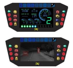
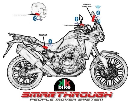
 I imagined a dashboard (a sort of display panel) that was permanently installed on the motorbike at the rider's eye level.
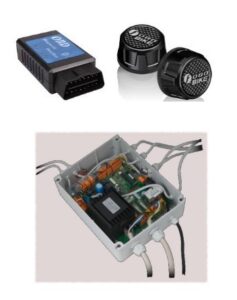
On this dashboard, the data of the vehicle (telemetry), converged, with indications coming from CAN-bus (Controller Area Network), then, detection and recording of every event concerning the motorbike (tyre pressure, fuel consumption, mileage, maintenance) as well as other data available through the use of other sensors (gyroscope, accelerometer, inclinometer, etc.).
In addition, a camera for day/night vision and recording (with en-route obstacle detection) was also implemented.
Other features that were implemented on the dashboard to serve the Smartrough, were the Road Navigator, the Map Navigator (useful in non-road, unmapped, or off-road routes), and the Digital Road Book (useful app for storing previously marked routes, for competitions or off-road tracks).
 The Smartrough System Control
The system was controlled by means of a handlebar remote control (useful for navigating through the various apps and operating them without lifting your hands from it) or by voice commands using a helmet intercom (in which the system's signals were also reproduced, and which also had a sensor that reported to the system the degree of inclination of the rider and passenger)..
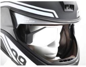
One of the features I had conceived was the Head-Up Display, which displayed information and news from the system on a lens attached to the helmet, thus allowing the rider to never divert his eyes from the road.
 Built-in GPS, anti-theft and rescue system
Through the GPS and other connections, it was also possible to track the motorbike anywhere (anti-theft), and with the help of the inclination sensor I also had a GPS and WIFI rescue system if the helmet and motorbike exceeded 60° of inclination (motorbike and rider on the ground), the system would initially try to send a call to the rider, and if there was no reply within 60 seconds a rescue call would be sent to the connected call centre, providing coordinates and video of the incident.
The system was able to send travel, technical, and road data to a remote control centre that could be queried online, useful for the management of maintenance and other services; the cloud-based database also collected all useful information for assistance, for certification in the event of accidents, for error cases, and much more.
Why did it remain unrealized?
Too visionary?
I wouldn't say so, given that a few years later such a system (allow to say, not so complete) was adopted by the majority of manufacturers; much more simply, the ingenious idea (without false modesty) came to me at the wrong time, for the prototypes required the investment of a large sum of money which, at the time, I did not have.
I did not get stuck on this setback, those who have known me for a long time know that giving up is not in my nature, on the other hand, those who know me less will get an idea from reading the other articles on my blog.
Read more:

